The Hurricane Gilma to Maintain Hurricane Status For Another 24hrs Despite ongoing gradual weakening trend
Hurricane Update: 1:56 AM, Monday, August 26, 2024 Hawaii Standard Time (HST)
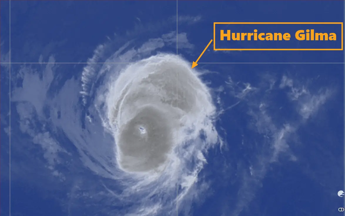
Hurricane Gilma, the 7th named storm of the Eastern Pacific hurricane season, is currently making its way westward across the Pacific Ocean.
With sustained winds near 100 mph (155 km/h) and higher gusts, it remains a formidable hurricane, though signs of gradual weakening have started to appear. Gilma is expected to stay strong enough to maintain hurricane status as it approaches the central Pacific Basin over the coming days.
Hurricane Gilma’s Current Position and Movement
As of the latest advisory from the National Hurricane Center at 11:00 PM HST on Sunday, August 25, 2024, Hurricane Gilma was located near latitude 18.1 North and longitude 135.9 West, placing it about 1,260 miles (2,025 kilometers) east of Hilo, Hawaii.
The storm is moving westward at a pace of 9 mph (15 km/h). A slight shift towards the west-northwest and increase in forward speed is predicted on Tuesday evening.
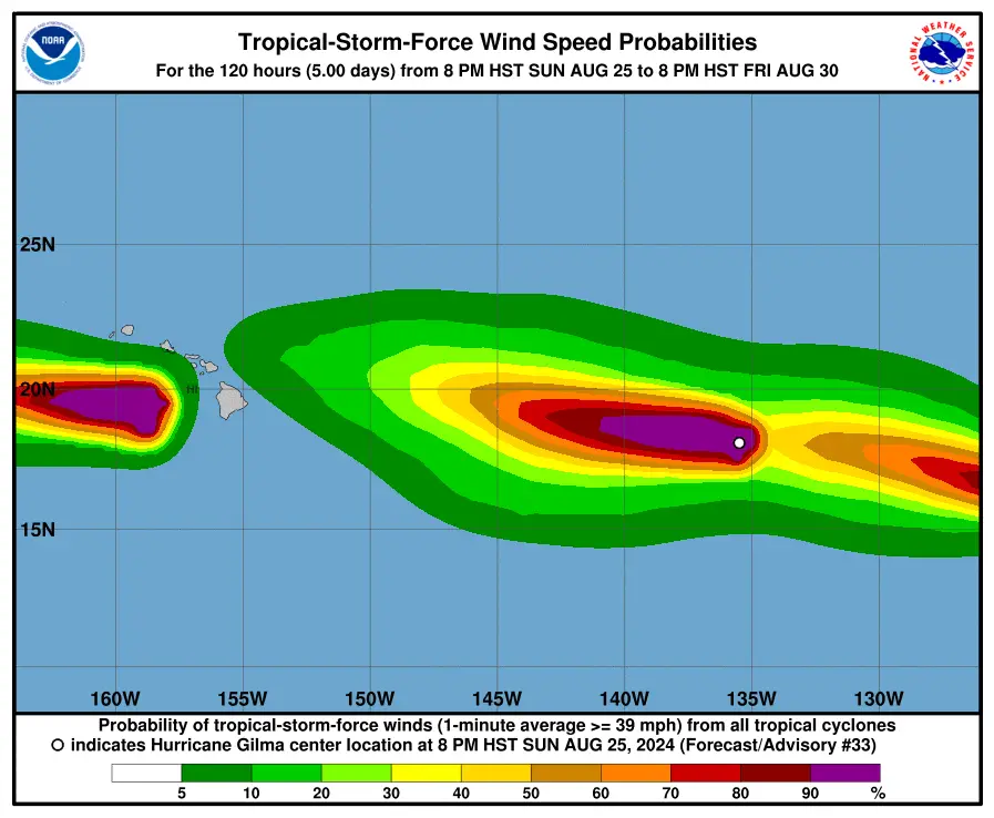
Wind Speed and Pressure of Hurricane Gilma Estimated By National Hurricane Center
Gilma continues to pack powerful winds despite its gradual weakening trend. Maximum sustained winds have been recorded at 100 mph (155 km/h), making it a strong Category 2 hurricane.
Hurricane-force winds extend up to 15 miles (30 kilometers) from the center, while tropical-storm-force winds reach outward up to 70 miles (110 kilometers). The minimum central pressure is estimated at 977 mb (28.85 inches), indicative of its intensity.
Forecast and Future Path Of Gilma
While Gilma’s strength is expected to diminish over the next couple of days, it will likely remain a hurricane as it progresses westward toward the central Pacific.
In the coming 12 to 24 hours, it will continue to weaken as it tracks further from the warm waters that fueled its growth.
-
In 12 hours, Gilma’s sustained winds are expected to decrease slightly to 80 knots (92 mph) with gusts up to 100 knots (115 mph).
-
In 24 hours, winds will continue to weaken to around 70 knots (81 mph) with gusts at 85 knots (98 mph).
By 48 to 72 hours, Gilma is forecasted to weaken further, potentially transitioning into a post-tropical system by the 96-hour mark.
Despite weakening, the hurricane is expected to maintain some impact over open water as it travels in the west-northwest direction at around 10 knots (11.5 mph).
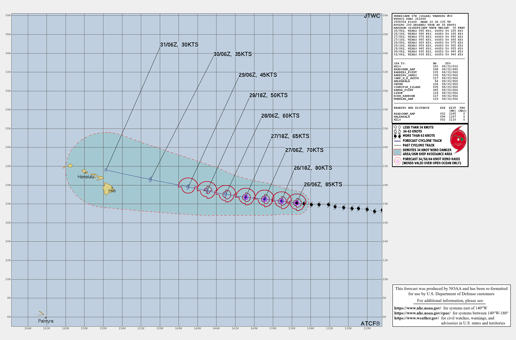
Impact on Land and Ocean Conditions due to hurricane Gilma
No coastal watches or warnings are currently in effect, as Hurricane Gilma remains over open water, posing no immediate threat to land.
However, the storm has been generating significant wave heights of up to 30 feet in its vicinity, a hazard for shipping and marine activities. Mariners should avoid the affected areas until conditions stabilize.
Tropical Storm Hector and Related Systems
In addition to Hurricane Gilma, there is another active tropical cyclone in the Eastern Pacific, Tropical Storm Hector.
Updates on this storm are being issued regularly, and it is important for those in the Pacific region to remain informed on both systems.
Check TS Hector update here: Global Weather
Overall scenario of Hurricane Gilma over eastern Pacific
While Hurricane Gilma is expected to weaken over the coming days, its current intensity makes it a storm to watch closely.
As it moves westward, its interaction with cooler waters and less favorable atmospheric conditions will gradually reduce its strength, eventually leading to its transition into a post-tropical system.
Nevertheless, it is crucial for residents and mariners in the central Pacific region to stay updated on Gilma’s progress
Advertisements

