Latest Update on Tropical Cyclone Alfred (TC 18P) – March 7, 2025, 15:00 UTC
Current Status of Tropical Cyclone Alfred
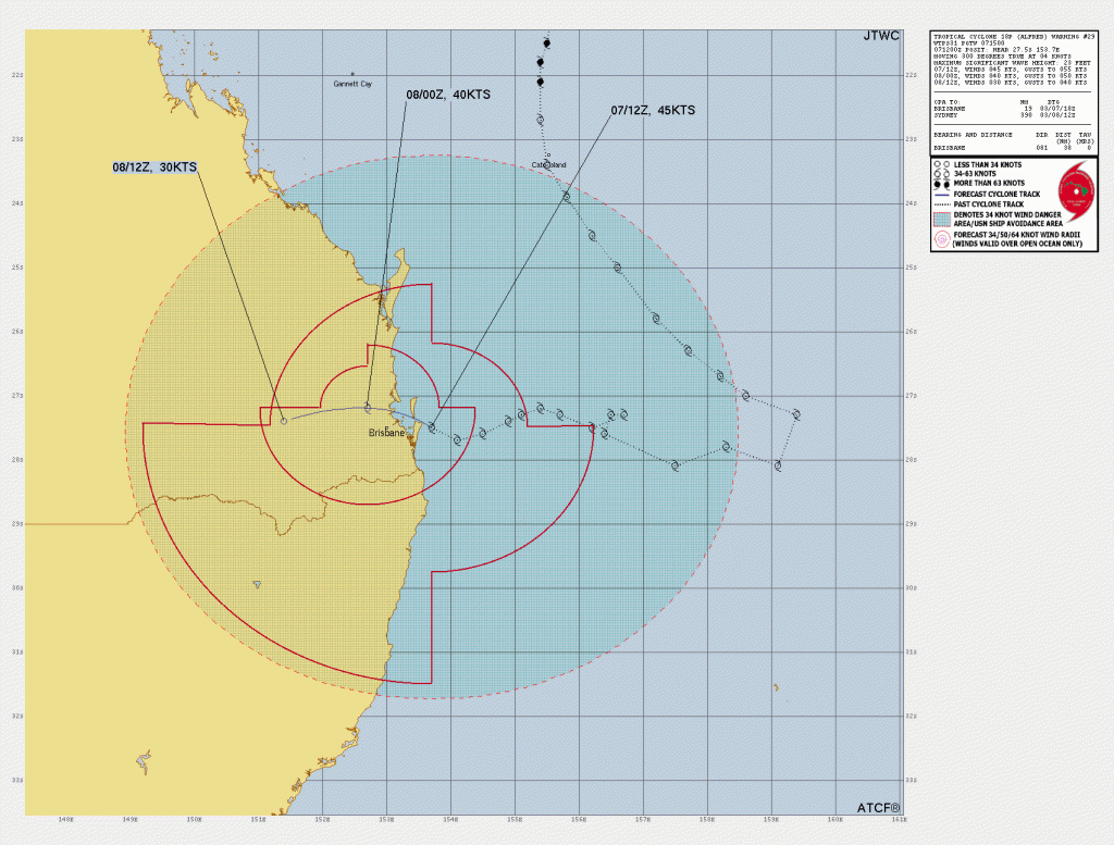
Tropical Cyclone Alfred (TC 18P) was positioned at 27.5°S, 153.7°E, approximately 70 km east of Brisbane, Australia. The cyclone has sustained winds of 83 km/h (45 knots) and is moving west-northwest at 7 km/h (4 knots). Significant wave heights are recorded at 7 meters (23 feet).
Satellite Analysis and Environmental Conditions
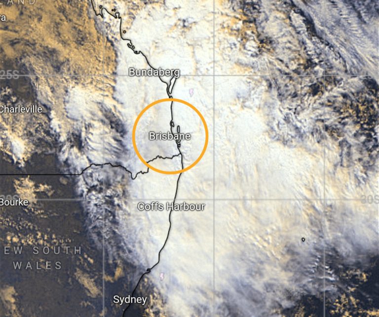
Satellite imagery reveals that TC Alfred maintains a symmetrical low-level circulation, with deep convection concentrated in the southern semicircle. Recent data indicates that the system is benefiting from slightly warmer waters (26-27°C) from the East Australian Current, leading to temporary intensity maintenance.
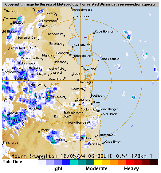
However, unfavorable environmental factors such as high vertical wind shear (46-55 km/h or 25-30 knots), land interaction, and dry air entrainment are limiting further development. Radar observations confirm that wind speeds near Main Beach, Gold Coast, have reached 76 km/h (41 knots), based on 10-minute averages.
Steering Mechanism and Current Movement as of Latest Update on Tropical Cyclone Alfred
The movement of TC Alfred is influenced by:
- A subtropical ridge (STR) located to the southwest
- A near-equatorial ridge (NER) to the northeast
This setup is steering the cyclone west-northwestward, bringing it closer to Moreton Island and North Stradbroke Island.
Forecast Track and Landfall Timing as of Latest Update on Tropical Cyclone Alfred
TC Alfred is already crossing Eastern Australian coast near Brisbane. It is expected to cross Moreton Bay Islands and make complete landfall just north of Brisbane within the next 12 hours. The STR to the south is currently the dominant steering factor, causing the system to turn west-northwestward in the past 6-12 hours.
Expected Changes in Intensity
- Short-term intensification possible: Slight convective strengthening may occur over the next 6 hours due to the system moving over warmer waters.
- Rapid weakening post-landfall: Increasing wind shear, land interaction, and an approaching upper-level trough will cause the system to deteriorate quickly.
- Dissipation within 24 hours: After landfall, TC Alfred is forecast to curve southwestward and fully dissipate by tomorrow.
Model Predictions and Forecast Confidence as of Latest Update on Tropical Cyclone Alfred
- Track models are in close agreement, with high confidence in the landfall position near Brisbane.
- Intensity models consistently predict rapid weakening, confirming that TC Alfred is unlikely to sustain itself beyond 24 hours.
Key Takeaways
- Landfall expected near Brisbane within 12 hours.
- Short-lived intensification possible but weakening likely after landfall.
- Residents should prepare for strong winds, heavy rainfall, and potential coastal impacts.
- Dissipation forecasted within 24 hours post-landfall.
Stay tuned for further updates on TC Alfred as it nears the Australian coast.
If You are in an old update, Check new updates here (Click Me)
Advertisements