SPECIAL TROPICAL WEATHER UPDATE!! BAY OF BENGAL AREA (80E-100E)
UPDATE DATE: 3RD MAY 2022 | UPDATE TIME: 09:30PM BST (+6 GMT)
SUBJECT: TROPICAL SYSTEM DEVELOPMENT | PERIOD: 4TH-08TH MAY 2022
=>
Under the influence of an Upper Air Circulation, A Low Pressure Area could form over South Andaman Sea adjoining South-East Bay of Bengal by 5th May 2022.
It could intensify into a Tropical Depression (≥45kph) by 6th May(late) over the same region & Subsequently into a Deep Depression by 7th May while tracking into NNW/NW direction.
.
▪️Due to having very favourable conditions ahead, it could intensify into a Significant Tropical Cyclone between 7-8th May 2022.
.
▪️Overall confidence in the forecast is high as an Upper Air Circulation has formed over South-East BoB adjoining South Andaman Sea.
And MJO signal found over Phase 3 with amplitude less than 1 and likely to gain amplitude over Eastern Equatorial Indian Ocean(ph 2-3) , which is favourable for Tropical Development over Bay of Bengal.
Also Sea Surface Temperature is very high(30-32°C) over major parts of the sea, which is very conductive for the development process.
.
Wind Shear is likely to be Low to Moderate (⬇) over the development area during 5-8 May. Also other relevant parameters are likely to be favourable during the forecast period.
The combination of these parameters could cause very favourable environment through the whole forecast period.
That’s why, It is having some notable chances to intensify into a Cyclonic Storm.
.
•Max intensity is dependent on the track & future condition of the BOB. So currently, max intensity looks skeptical.
.
Thus, The UAC, MJO, favourable VWS & other favourable parameters are leading High confidence in this forecast.
.
◾ LANDFALL & MAX INTENSITY:-
Landfall is anticipated between North Odisha to SW Bangladesh coast as a Significant Tropical Cyclone between 10-11 May 2022(may vary).
Max intensity is skeptical & anticipated with the track of the system.
.
⚠️Effects:-
Due to the direct impact of the Potential Cyclone, “Odisha, West Bengal & parts of Bangladesh could have Heavy to Very Heavy rain along with Strong Tropical Squalls & Isolated Extremely Heavy falls between 10-14 May 2022.
.
Northern Bay of Bengal could have very rough seas between 9-11 May 2022.
.
☔RAINFALL:-
Due to the direct impact of the System/Cyclone, “Odisha, West Bengal & parts of Bangladesh could have Heavy to Very Heavy rain along with Strong Tropical Squalls & Isolated Extremely Heavy falls between 10-14 May 2022.
.
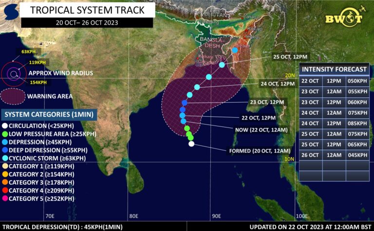
▪️See the graphic to see the development area & heavy rainfall potential area.
.
*NB: This forecast includes Rainfall Activity only by direct influence of the Tropical system which is based on the probable track.
It could be changed if the track changes!
.
★Note:-
These informations are based on Present conditions & it might be changed somewhere during the entire forecast period.
So, keep eye on the latest update for better information.
=>
Stay connected, Stay alert, Stay Safe.
Thanks,©BWOT
Bangladesh Weather Observation Team (BWOT).

Advertisements

